The Challenge
The property is dense hardwood timber along a winding river channel, bordered by a levee and a county road, with only one cleared field. Photogrammetry alone sees the tops of the trees, not the ground beneath them. The client needed true terrain under the canopy, plus imagery clear enough to read the site at a glance.
The Approach
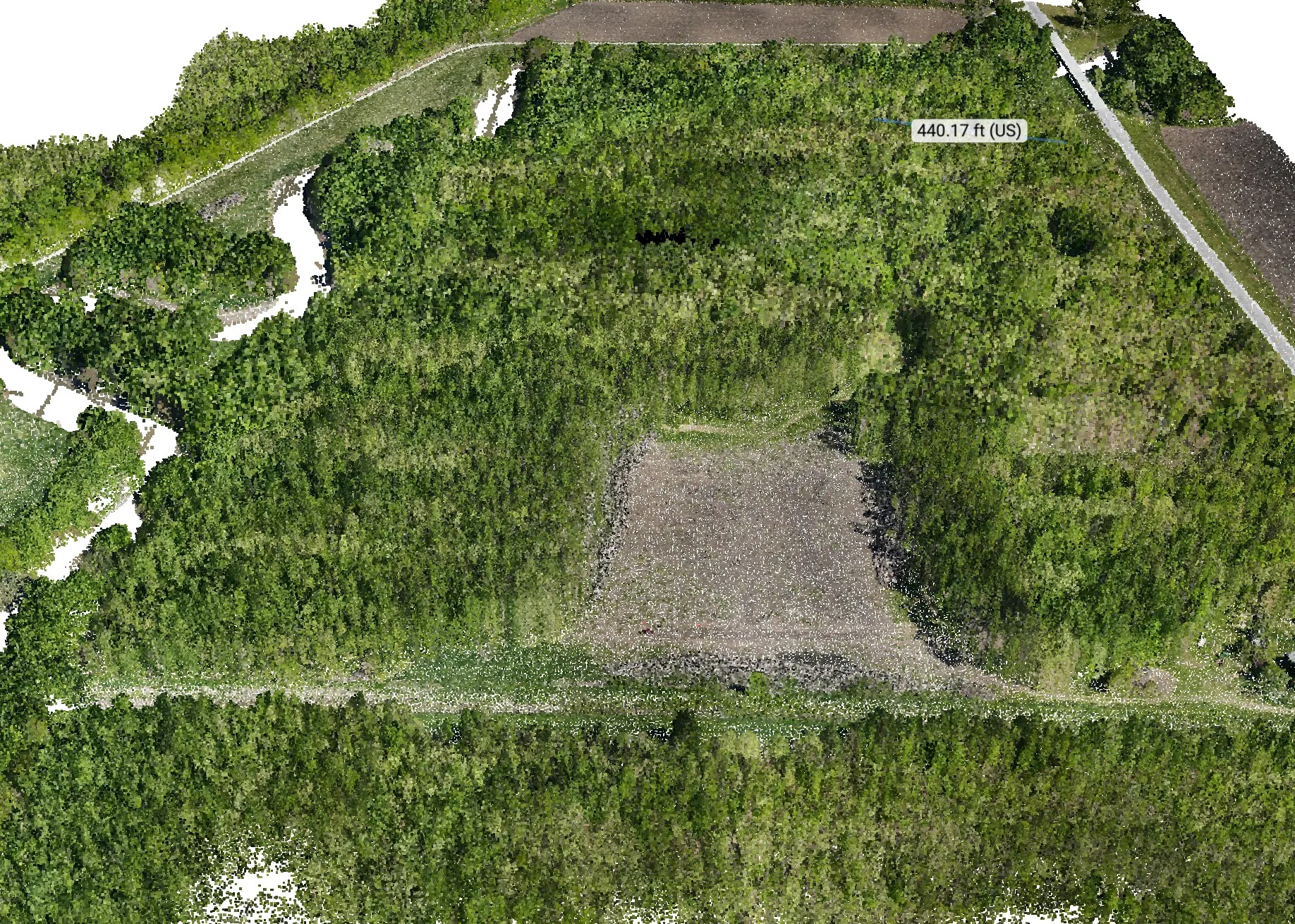
We flew the site twice with the WingtraRAY: once with the Wingtra LiDAR payload to capture ground returns through the canopy, and once with the 61-megapixel MAP61 camera for a high-resolution orthomosaic. We then fused the orthomosaic onto the LiDAR data, assigning real color to every point. The result is a 3D model that looks like a photograph but carries the measurement accuracy of LiDAR.
Site Conditions
Full summer leaf-on canopy covered most of the site, with steep cut banks along the river meanders, a raised levee, and drainage ditches along the field edges. Fixed-wing coverage made it practical to map the full parcel and surrounding corridor in a short window.
Results
- ▸Ground terrain captured beneath dense, leaf-on forest canopy
- ▸Contours clearly define the river banks, levee, road ditches, and subtle ridges and swales across the wooded interior
- ▸Cross-check: the same reference line measured 438.89 ft on the orthomosaic and 440.17 ft in the point cloud, a difference of about 0.3 percent
- ▸One dataset now serves planning, drainage, timber, and property review
