[ Case Study ]

Linear Infrastructure Corridor Mapping

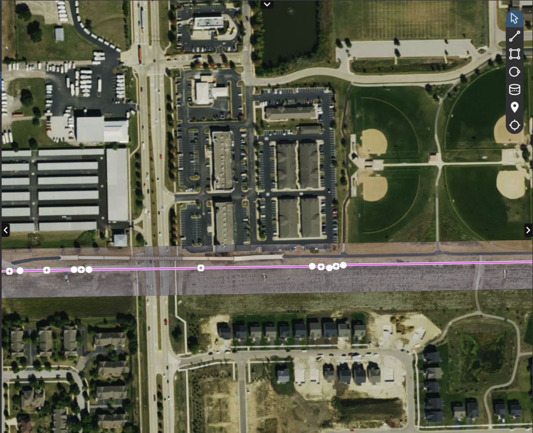
Aerial orthomosaic strip of the corridor overlaid on satellite imagery with alignment vector
[ Project Snapshot ]
Client
[Client type]
Location
[County], [State]
Date
[Month Day, 2026]
Site area
[X] acres
Aircraft
WingtraOne
Payload
[Payload]
Flight time
[X] minutes
Processing
[software]
Deliverables
Orthomosaic, Corridor Alignment, GIS Delivery
Turnaround
[X] business days

The Challenge

[Describe the site and what the client needed.]

The Approach

High-resolution orthomosaic survey of a linear infrastructure corridor spanning multiple intersections and right-of-way boundaries. Corridor alignment overlaid on base map for immediate GIS integration. Deliverables support utility planning, right-of-way documentation, and municipal infrastructure management.

Service: Drone Mapping

Site Conditions

[Add terrain, vegetation, weather, or airspace notes.]

Results

  • ▸Pipeline routing
  • ▸Utility right-of-way
  • ▸Municipal infrastructure
  • ▸Road and rail corridor documentation

Deliverables

Orthomosaic + Alignment

Survey strip on aerial basemap

Alignment on Basemap

GIS-ready right-of-way overlay

Why It Matters

[Add why this project matters to clients.]

Have a similar project? Request a Drone Mapping quote.

Request a Quote
Managed byPraevarios
